Google Street View was launched in 2007 in several cities in the United States, and has since expanded to include cities and rural areas worldwide.
 |
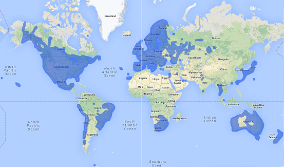
| Maps with areas highlighted in blue support Street View imagery |
This feature of Google Maps provides a view of actual images of streets and objects as if you were walking there.
According to Wikipedia, the option to view Street-level imagery from the past has been introduced in 2014. It is only available where Google has imaged a street more than once.
To start viewing Street-level imagery click the Pegman in the bottom right corner. Any roads which have Street View imagery will appear highlighted in blue. Click on a highlighted part of the map to see Street View.
If past imagery is available, there is an overlay in the upper-right corner with the address and Street View date which can be changed to view images over time.
 |
Street View image showing a Safeway supermarket. Notice a building under construction in the background in October 2007
|
 |
| The supermarket is gone. The building in the background is ready in August 2011. |
Street View is currently available in India only in certain areas of a few cities (shown in blue)


Comments
Post a Comment